
Go to documentation repository
Note.
If an external map is selected as a background, the layer is automatically binded to geographical coordinates – see also Configuring the external Map server
Set map binding to coordinate grid as follows:
- Start the Map editor utility for the required map layer (for details, see Configuring the interactive map for object state indication and controlling the objects section in Administrator's Guide).
- Display the Properties panel to edit the object properties on the map (see Editing object properties using the Properties panel).
- Select Add geotagging in the Map menu.
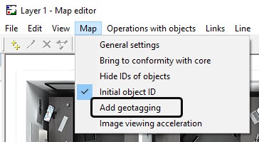
- The axes will be arranged on the map (1).
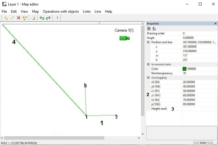
- Place points 1, 2 and 3 in positions corresponding to points with known coordinates (geographical or relative).
- Specify coordinates of points 0, 1 and 2 in the x0, y0, x1, y1, x2 and y2 fields respectively (2). The x coordinates correspond to longitude, and the y coordinates correspond to latitude.
- If geographical coordinates of points 0, 1 and 2 are specified correctly, then the axis (4) will point to the north. The coordinates of the point that the mouse cursor is over will be displayed in the status bar in the lower left corner of the Map Editor window.
- Shut down the Map editor utility and click the Apply button on the settings panel of the corresponding Layer object.
- As a result, the calculated coordinates of the point in the upper right corner of the map will be displayed in the Georeferencing field (1).
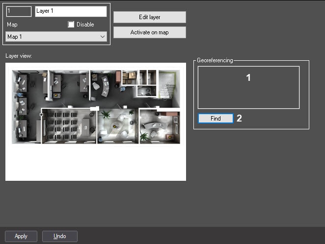
- Click the Find button to check if the settings were made correctly (2). As a result, the Google map will be opened in the default browser showing the specified coordinates.
Map is now bound to coordinate grid.
Overview
Content Tools